


Llanddarog, Carmarthen
Property Features
- Rare opportunity on periphery of sought-after Carmarthenshire village
- 115.94 acre improvable dairy farm
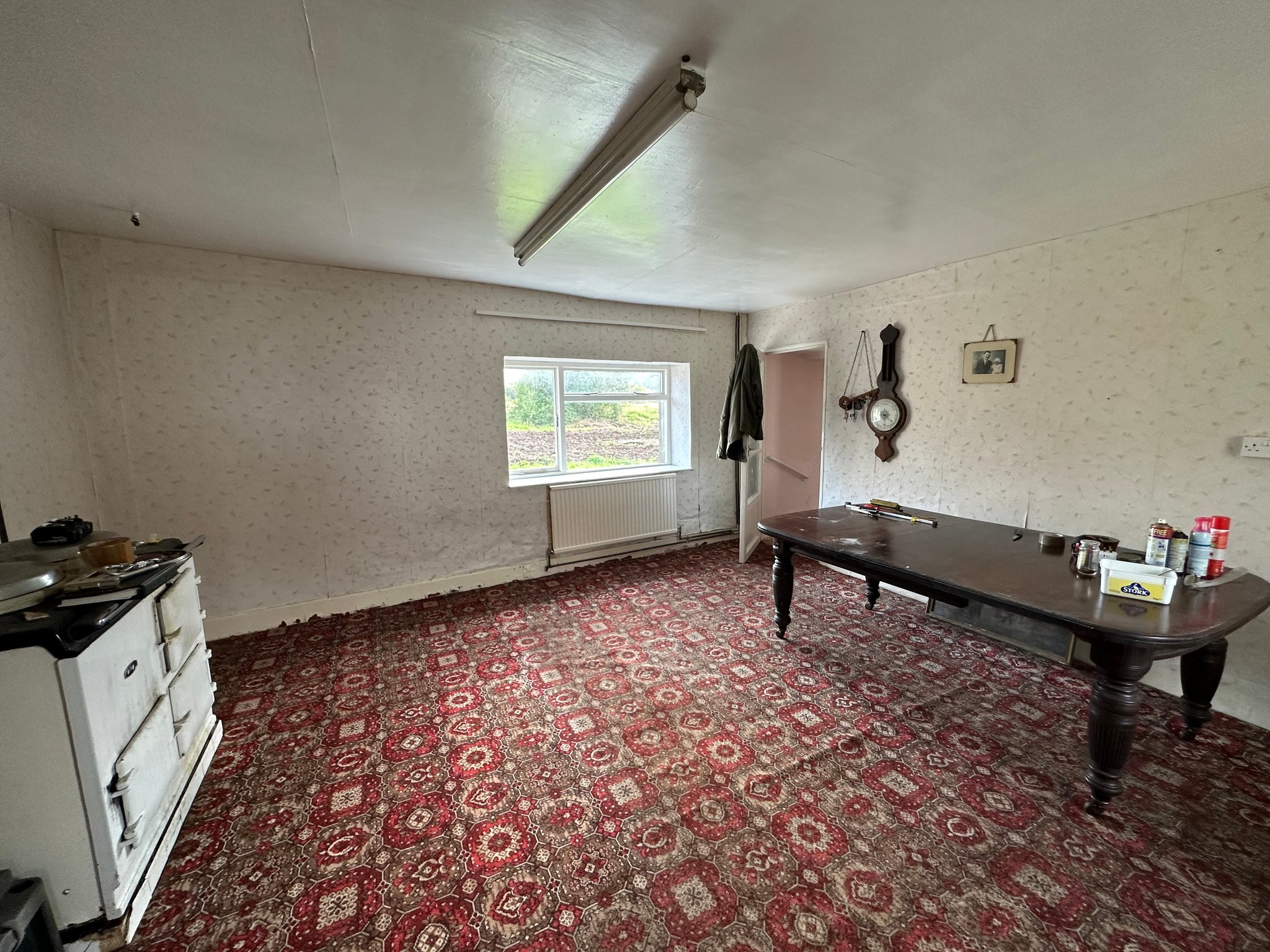
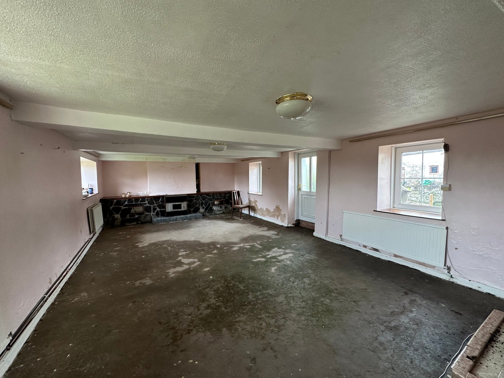
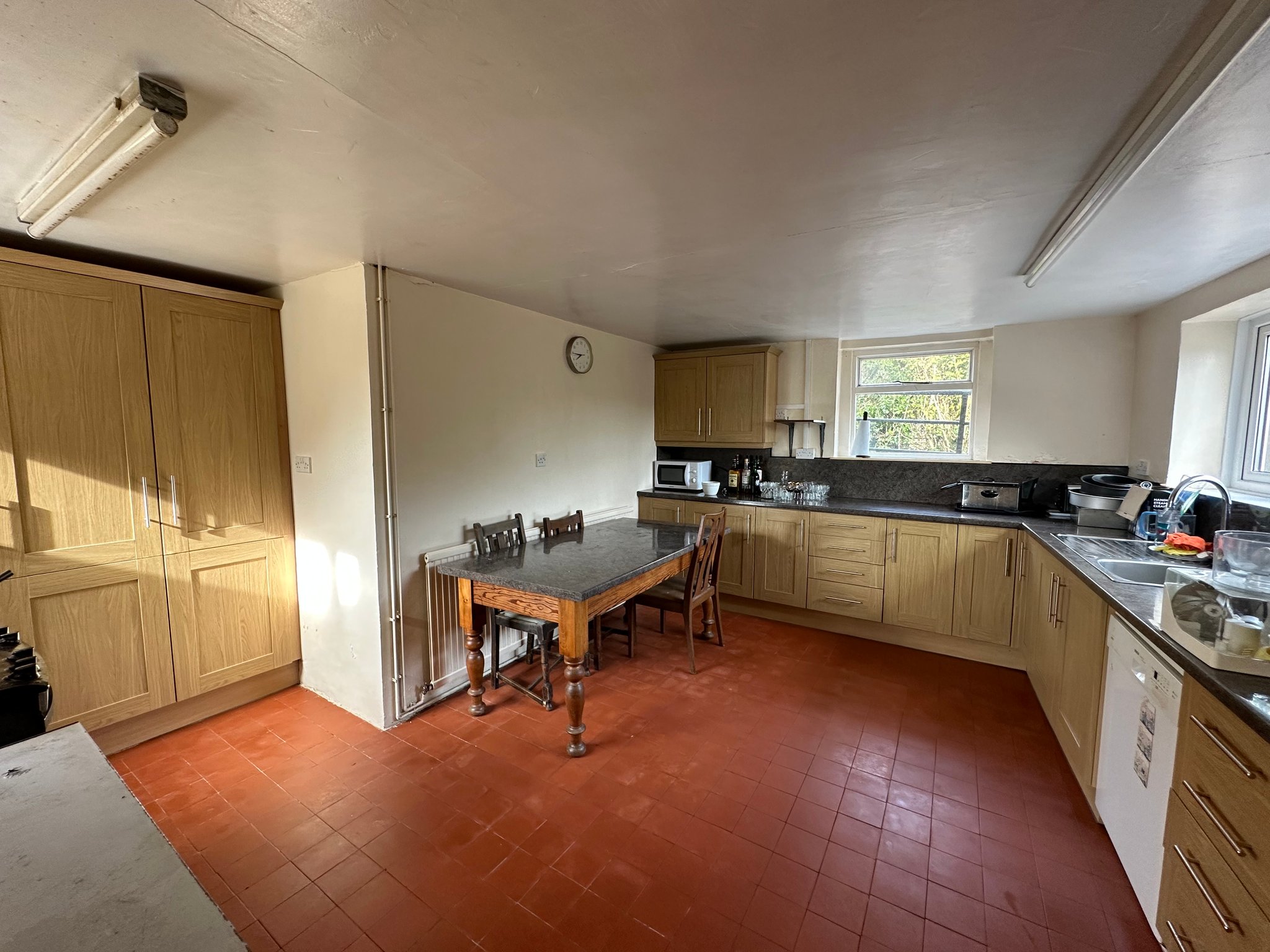
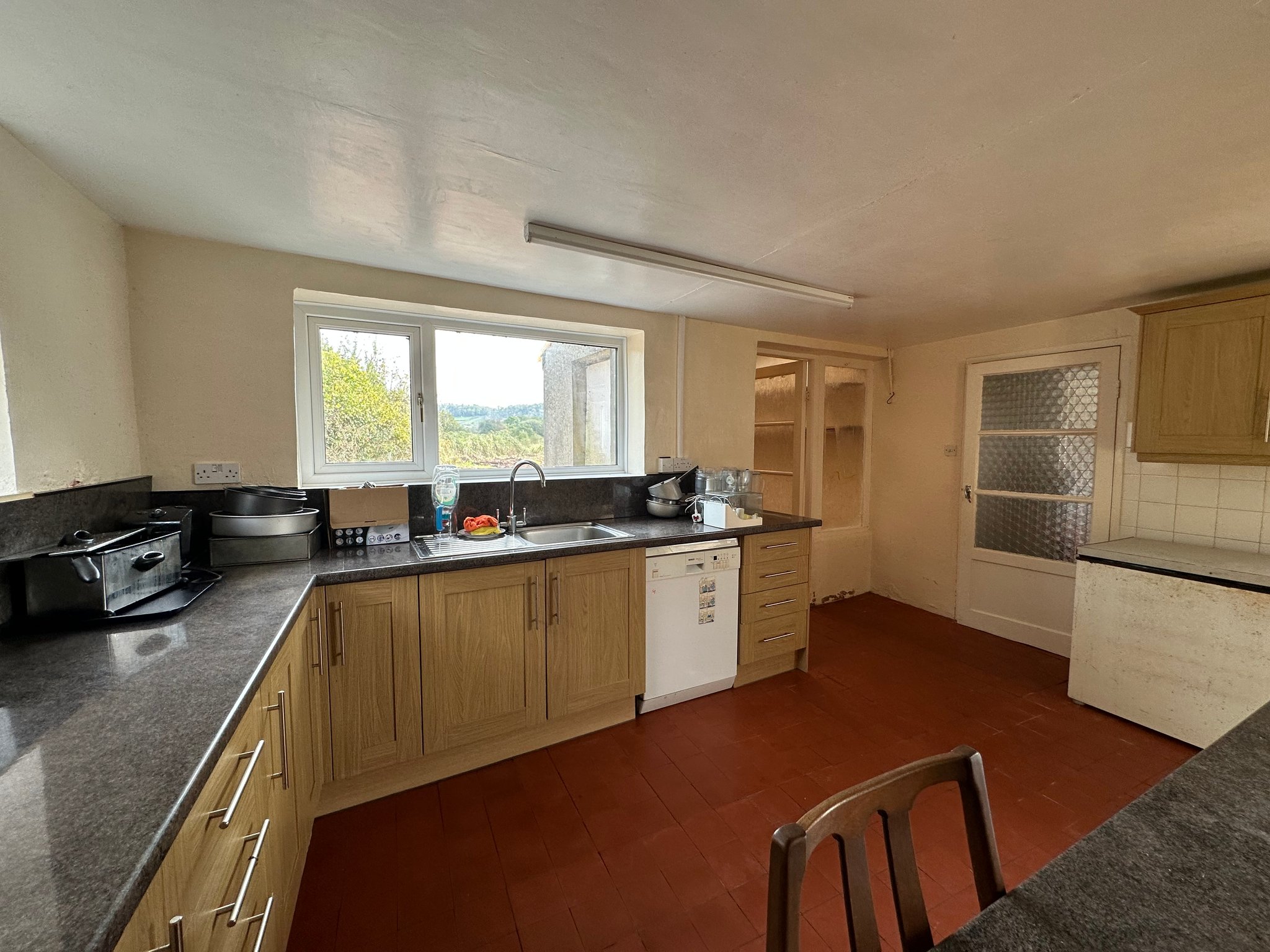
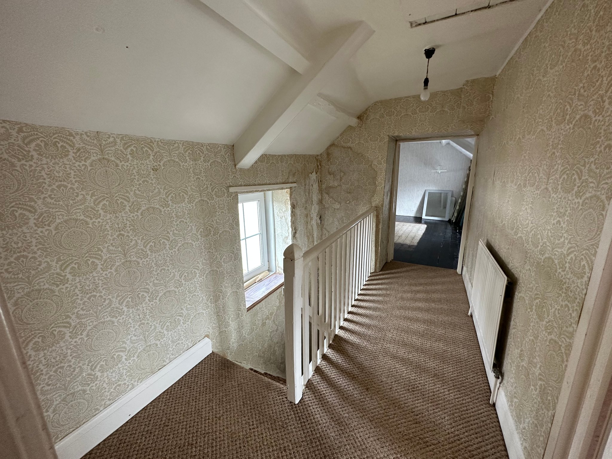
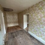
- 4-bedroom farmhouse in need of renovation.
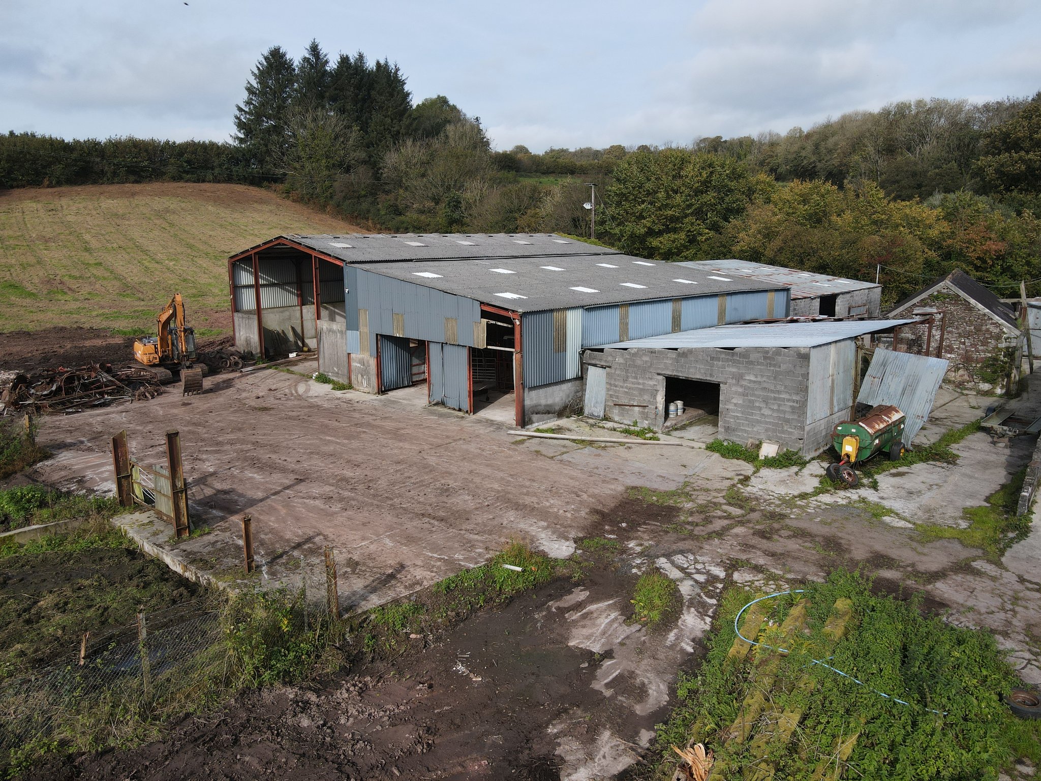
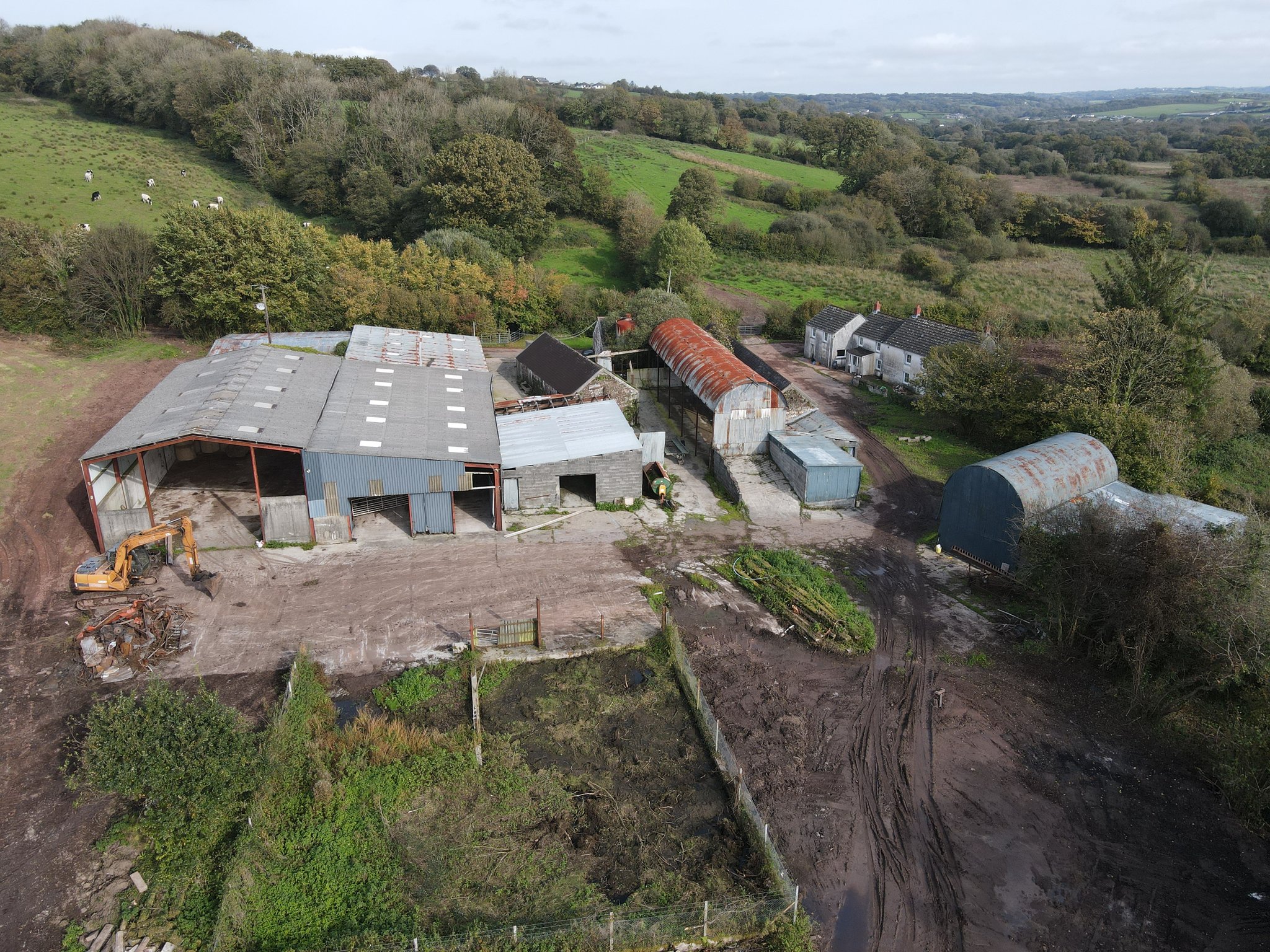
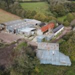
- Traditional stone and modern farm buildings
- South facing gently sloping to level land laid to pasture, being improvable in nature.
- 1 mile from A48 - M4 Link Road
Property Summary
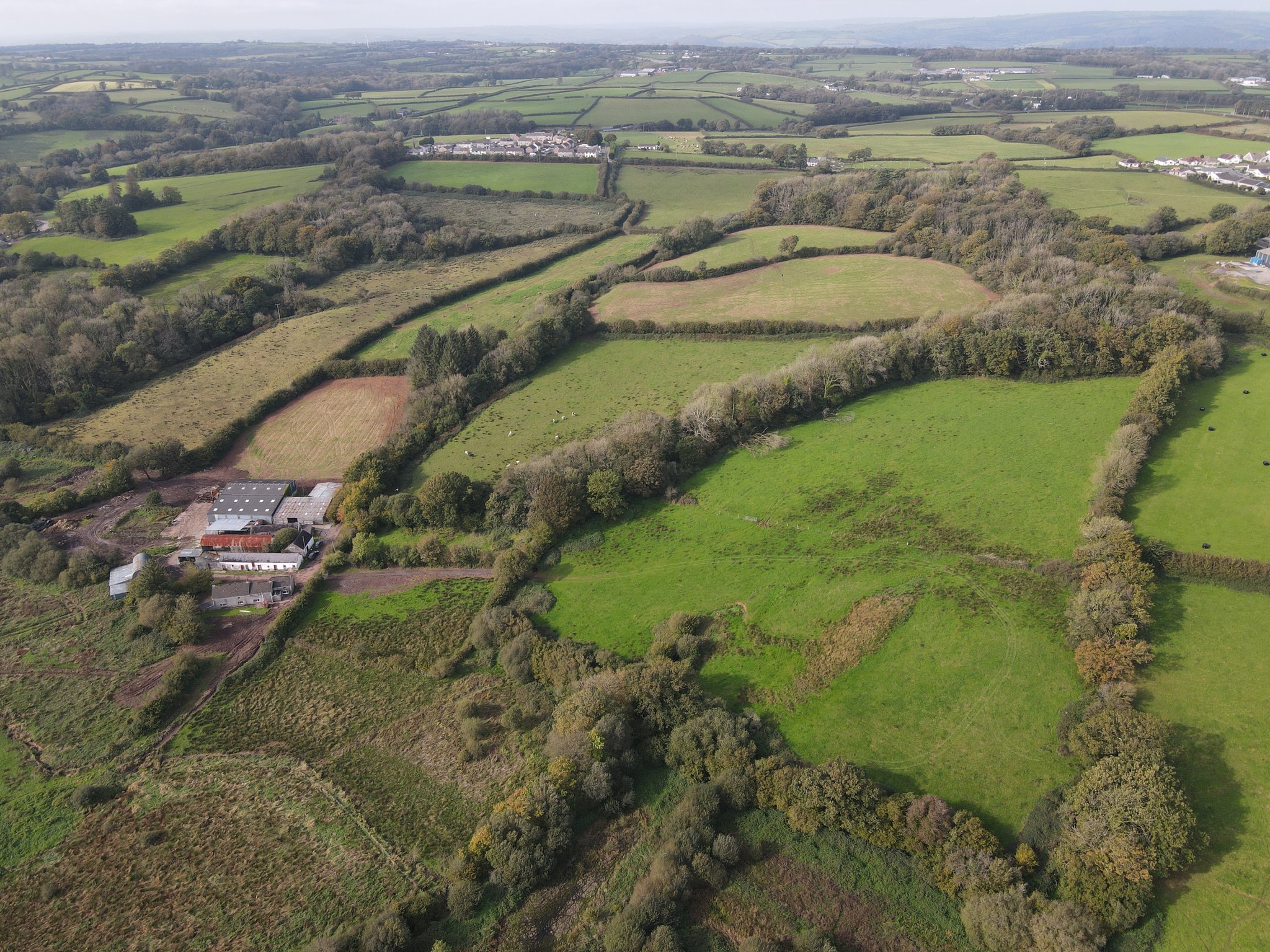
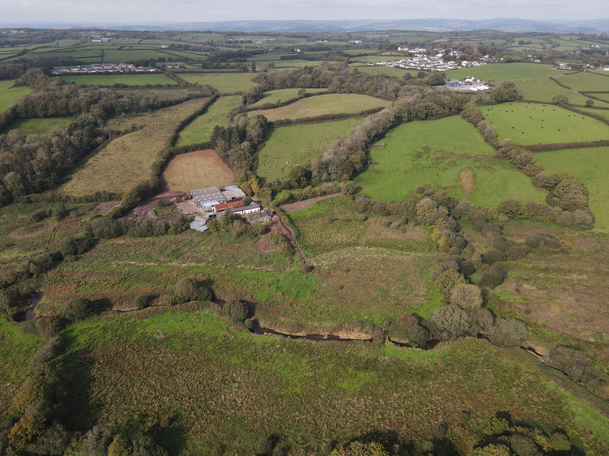
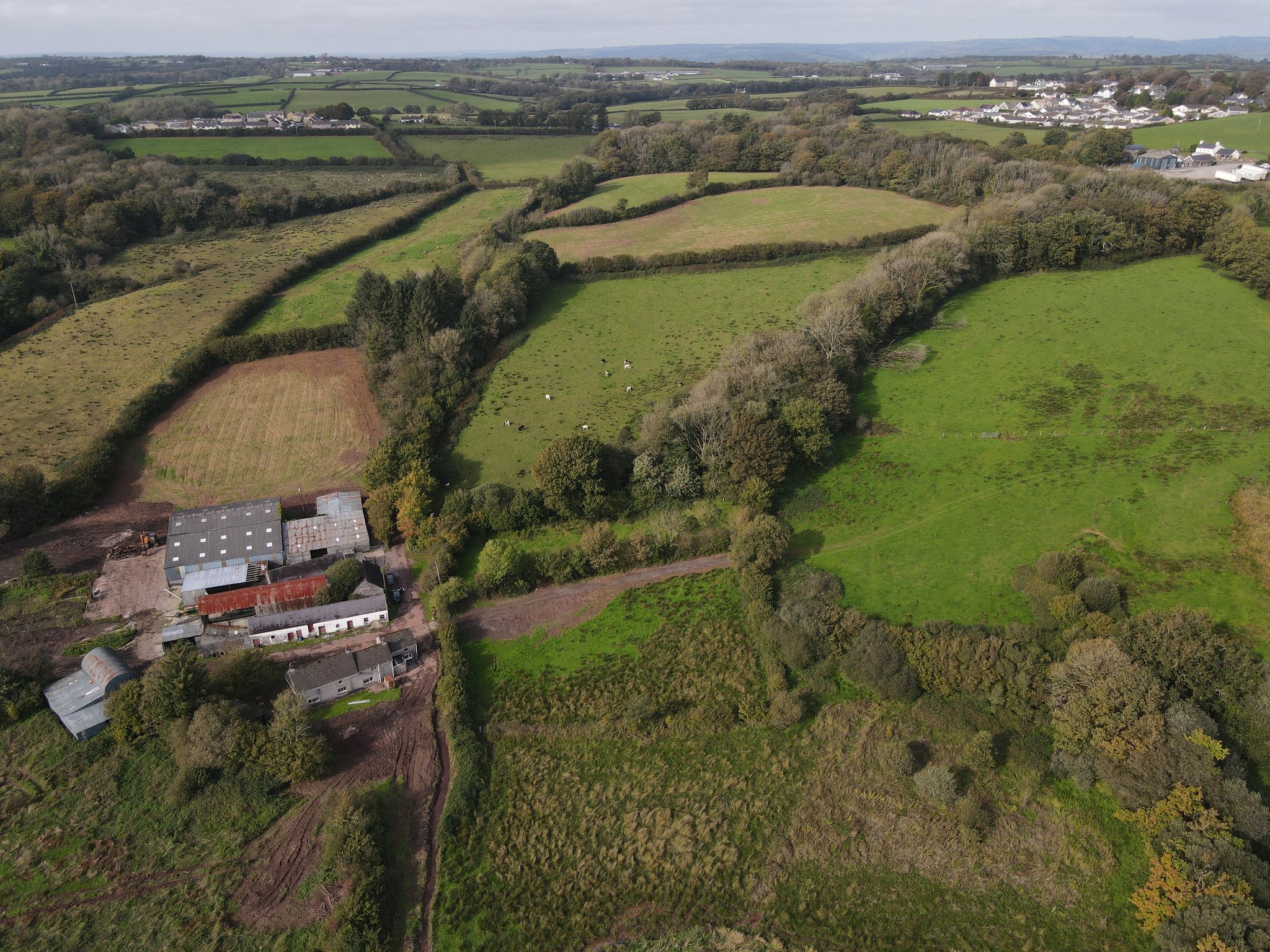
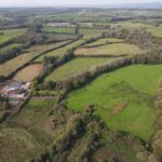
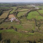
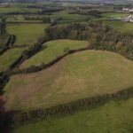
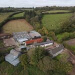
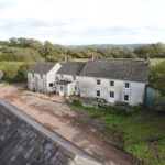
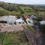
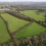
A rare opportunity to acquire a conveniently situated 115.94 acre former dairy farm on the periphery of the sought-after village of Llanddarog, Carmarthenshire.
Full Details
Description
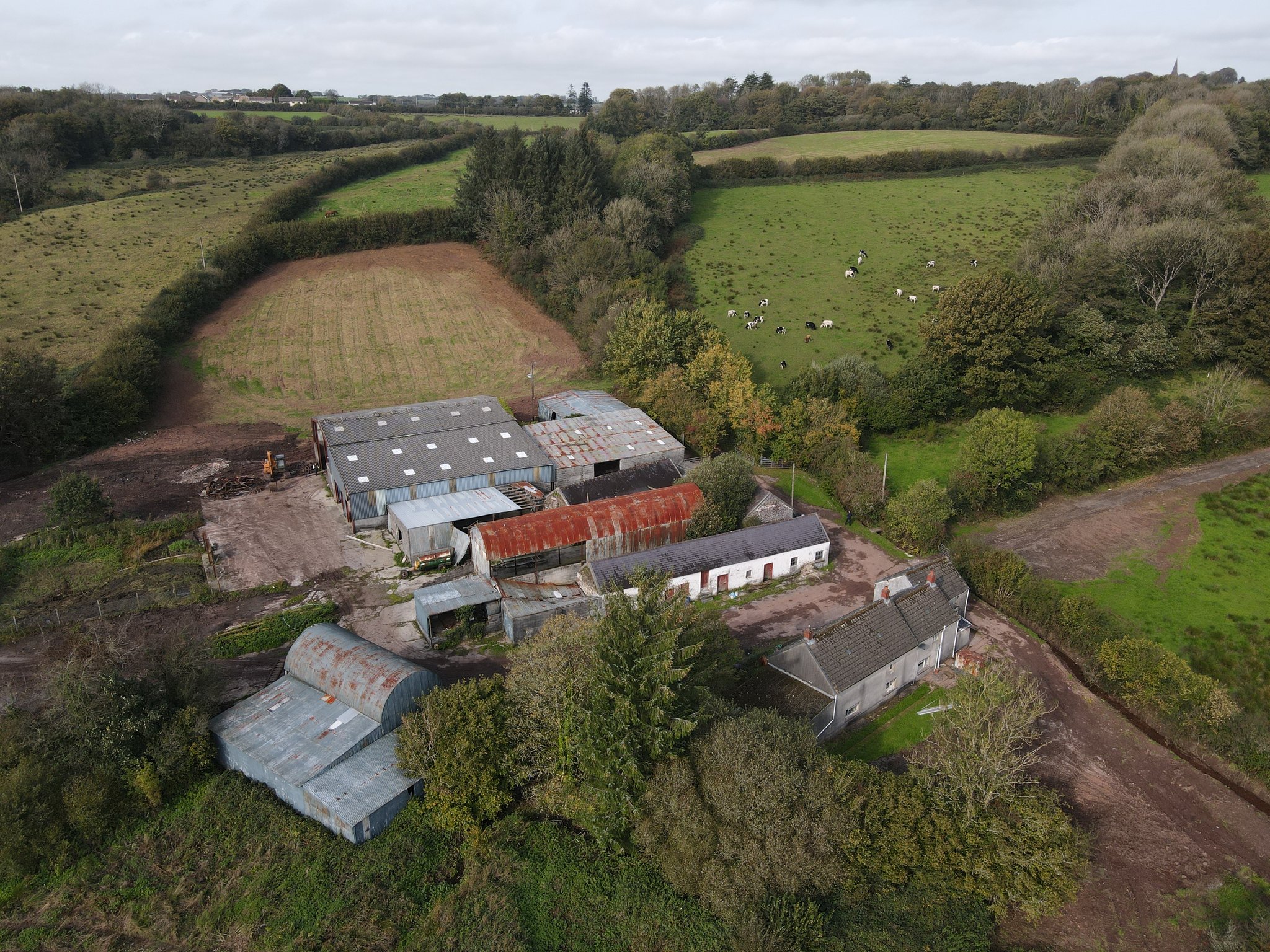
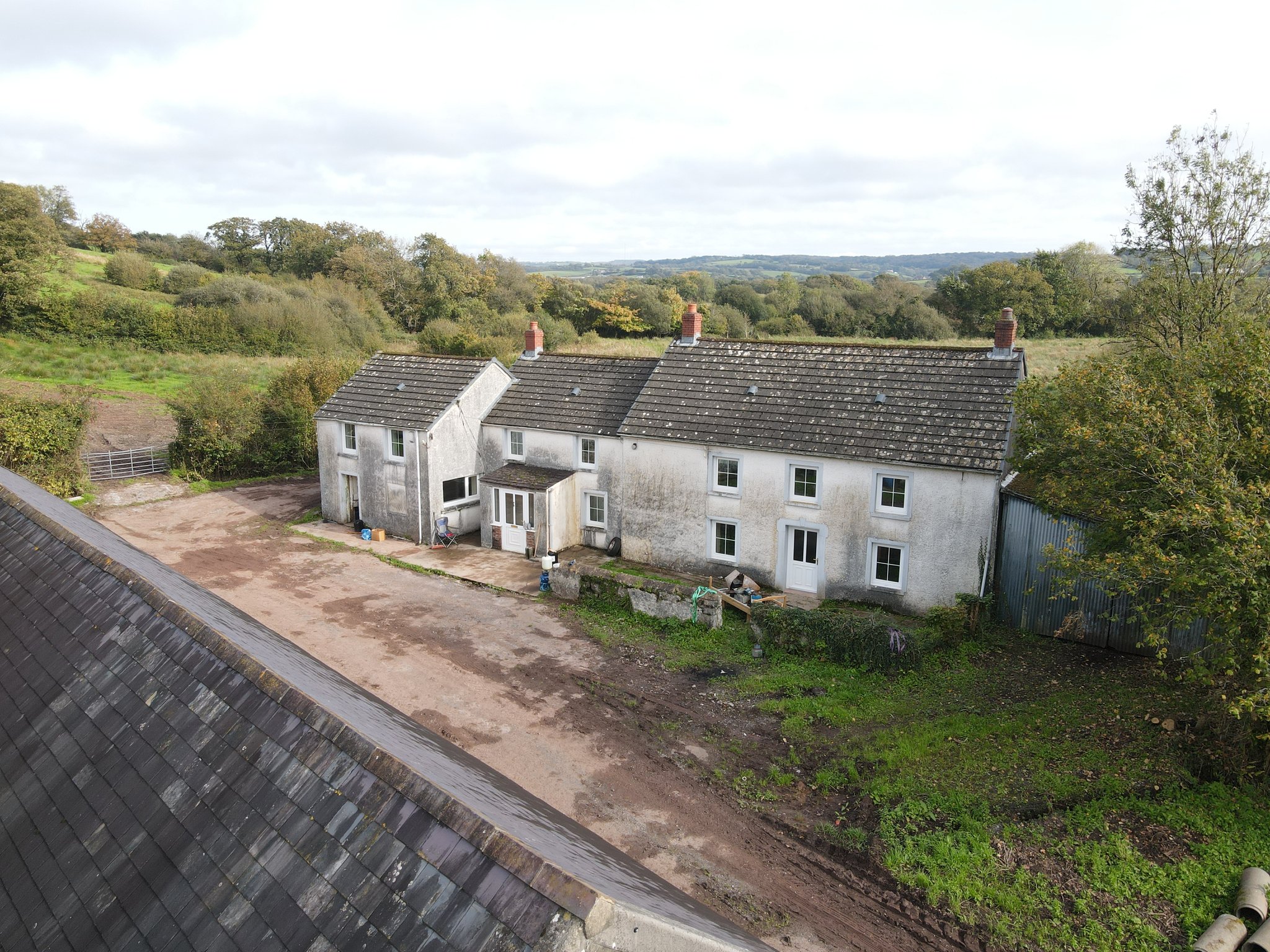
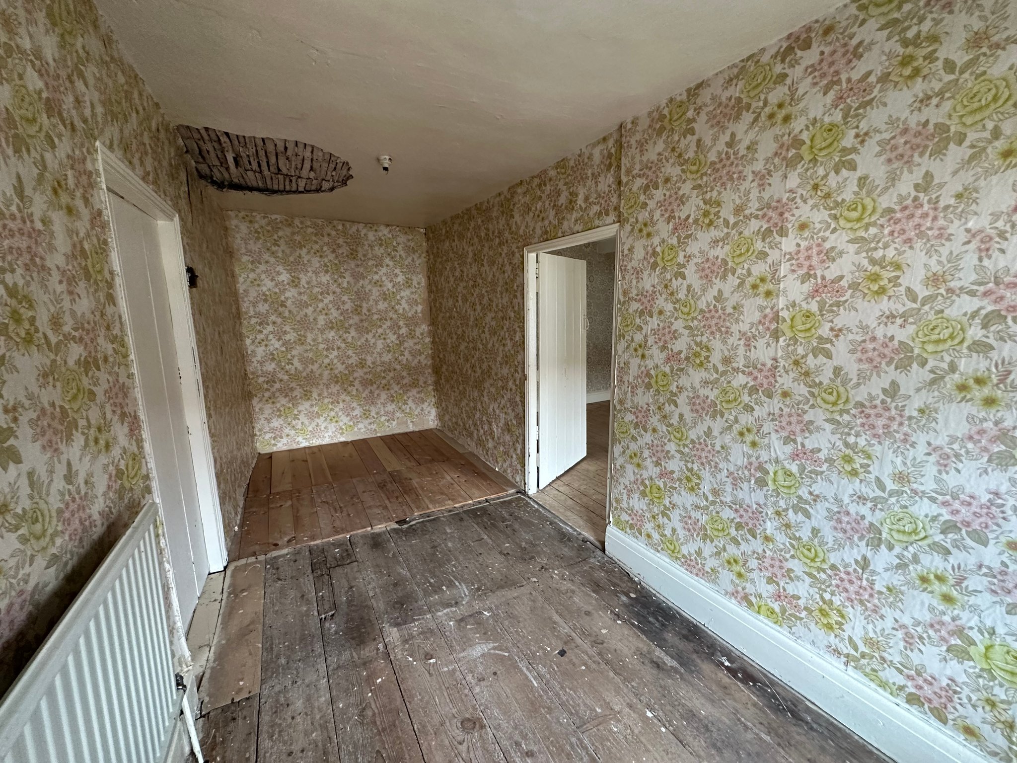
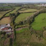
A rare opportunity to acquire a conveniently situated 115.94 acre former dairy farm on the periphery of the sought-after village of Llanddarog, Carmarthenshire, comprising a 4-bedroom detached farmhouse in need of renovation, a range of traditional stone and modern farm buildings, some with redevelopment opportunity subject to the necessary planning consents, and gently sloping to level land suitable for grazing and cutting, being improvable in nature.
Situation
The farm is situated on the periphery of the popular and sought after village of Llanddarog, Carmarthenshire, accessed directly off an unclassified adopted highway via concrete and hardcore access track, being 0.4 miles in length. The village itself is home to a range of local amenities and services including village store and post office, two public houses and a community primary school.
The A48 dual carriageway can be reached within a mile to the north, providing excellent road links into the county and market town of Carmarthen, 7 miles to the north-west and along the M4 corridor, with Junction 49 of the M4 being within 10 miles to the south-east.
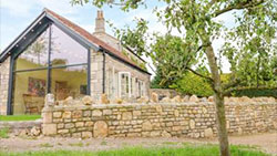
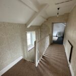
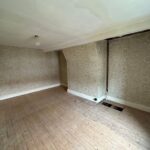
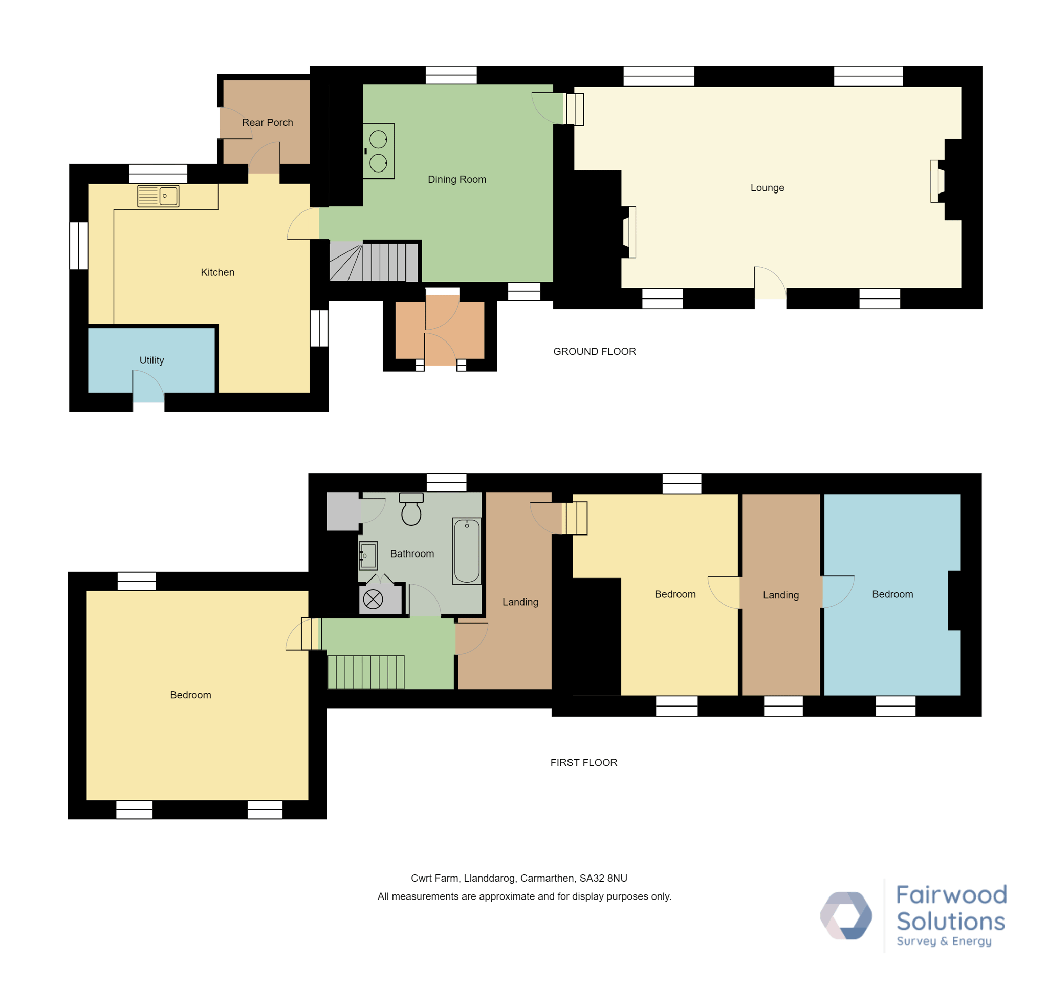
The Farmhouse
GROUND FLOOR
Front Entrance Porch
1.5m x 2.1m (4' 11" x 6' 11")
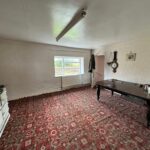
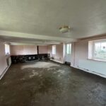
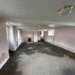
Sitting Room
4.87m x 4.69m (16' 0" x 15' 5")
Oil fired Aga. Understairs cupboard. Stairs to first floor. Carpet flooring. Window to rear. Steps leading down to:
Living Room
4.77m x 7.56m (15' 8" x 24' 10")
Fireplace. Central front door. Window to front and rear.
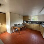
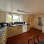
Kitchen/Dining Area
4.73m x 3.46m (15' 6" x 11' 4")
Base and wall units. Stainless steel sink. Plumbing for dishwasher. Window to rear and side. Red quarry tiles.
Walk-In Pantry / Rear Hall
1.87m x 1.99m (6' 2" x 6' 6")
Door to side. Red quarry tiles.
FIRST FLOOR
Landing Area
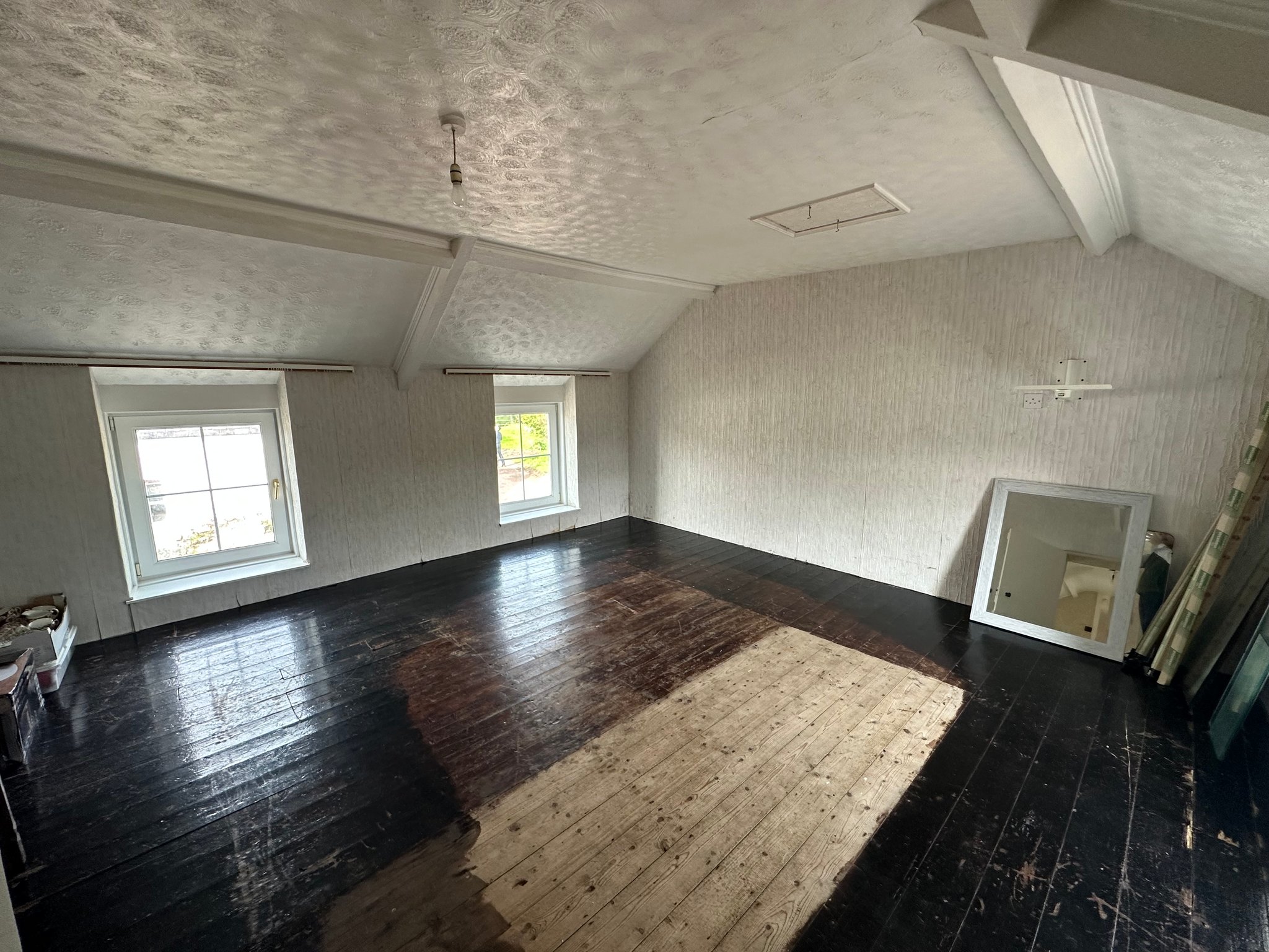
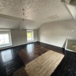
Bedroom 1
4.76m x 4.85m (15' 7" x 15' 11")
Dual aspect. Exposed floorboards. Attic hatch.
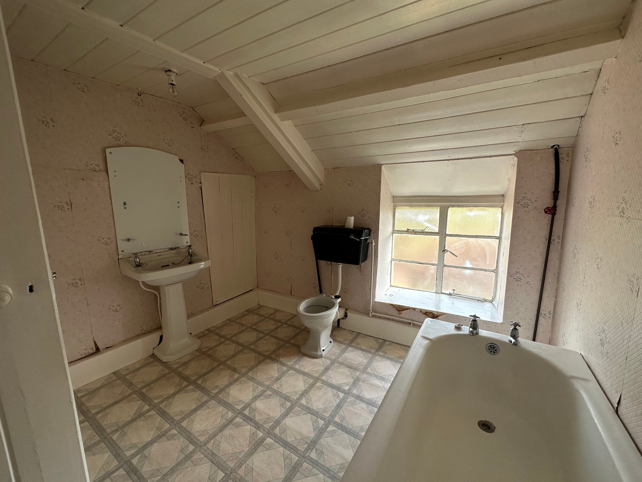
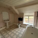
Family Bathroom
2.83m x 2.79m (9' 3" x 9' 2")
W.C., wash hand basin, bathtub and airing cupboard
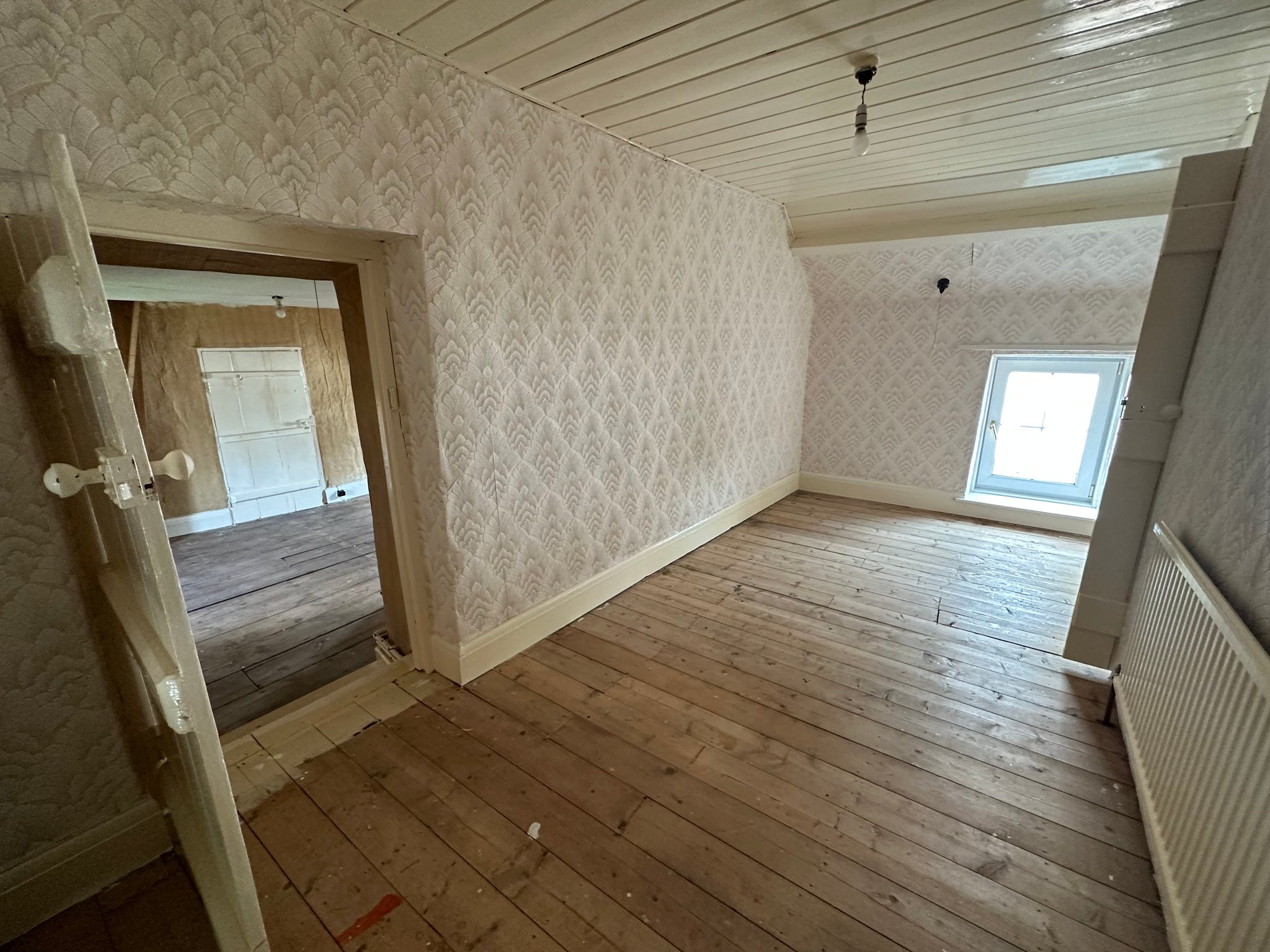
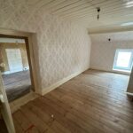
Bedroom 2
1.99m x 4.68m (6' 6" x 15' 4")
Exposed floorboards. Window to front. Door leading into Bedroom 3 and 4.
Bedroom 3
3.23m x 4.78m (10' 7" x 15' 8")
Exposed floorboards. Window to front. Door leading into internal hall.
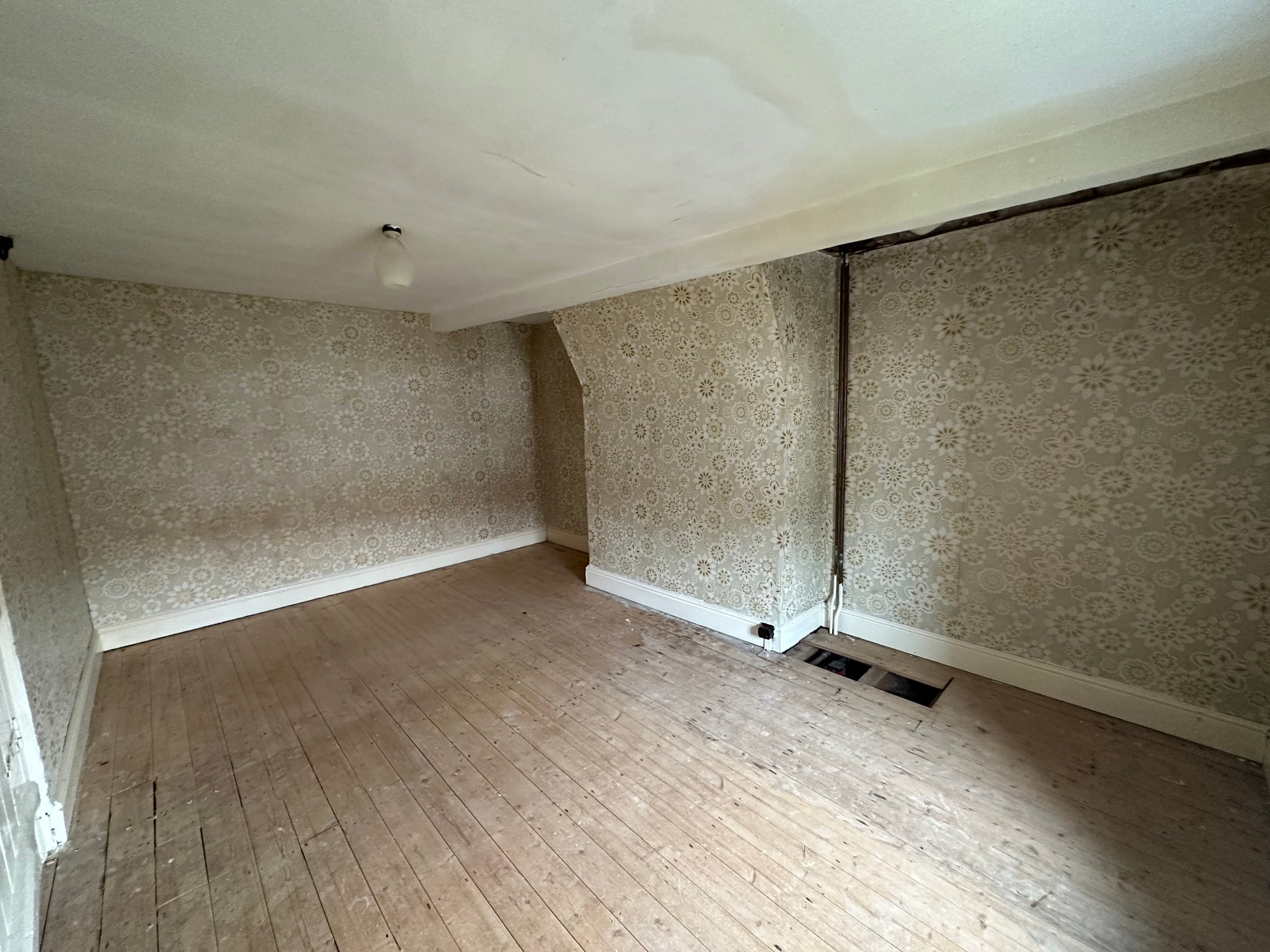
Former Landing Area / Internal Hall
1.84m x 4.78m (6' 0" x 15' 8")
Door leading into Bedroom 4.
Bedroom 4
3.19m x 4.72m (10' 6" x 15' 6")
Exposed floorboards. Window to front.
Externally
The farmhouse is set on a courtyard setting overlooking the traditional stone farm buildings, with an adjoining external washroom with plumbing for washing machine and tumble dryer. To the rear, the garden is laid to grass and houses the oil tank.
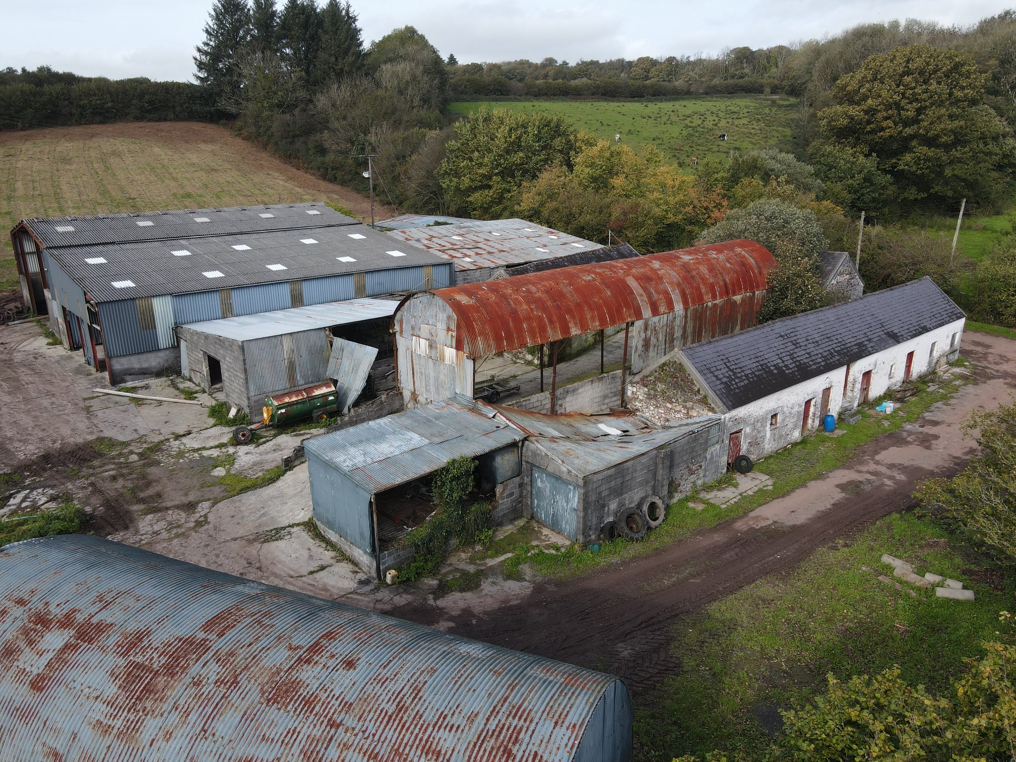
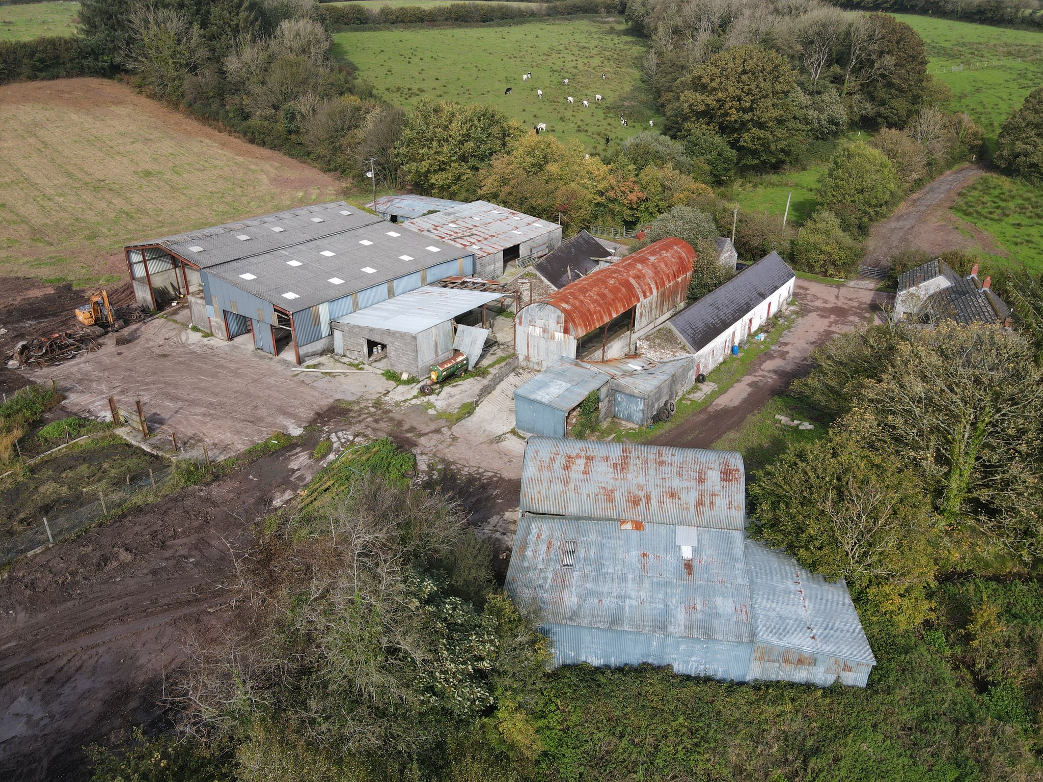
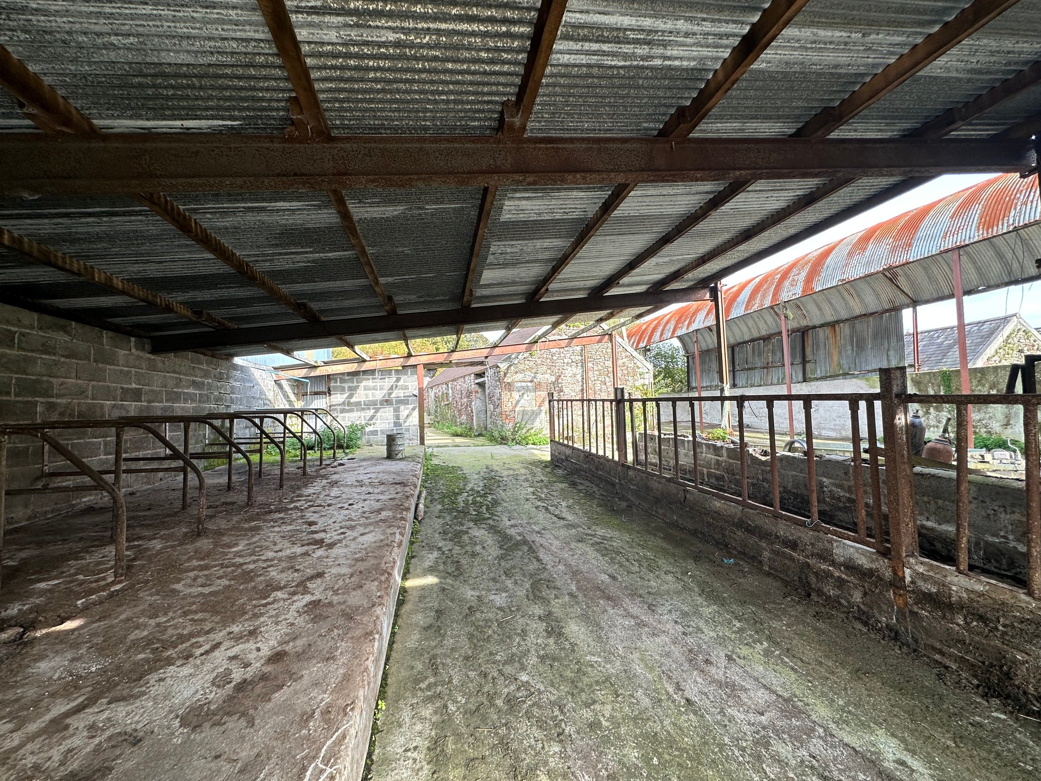
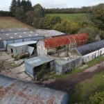
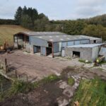
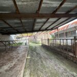
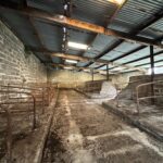
FARM BUILDINGS
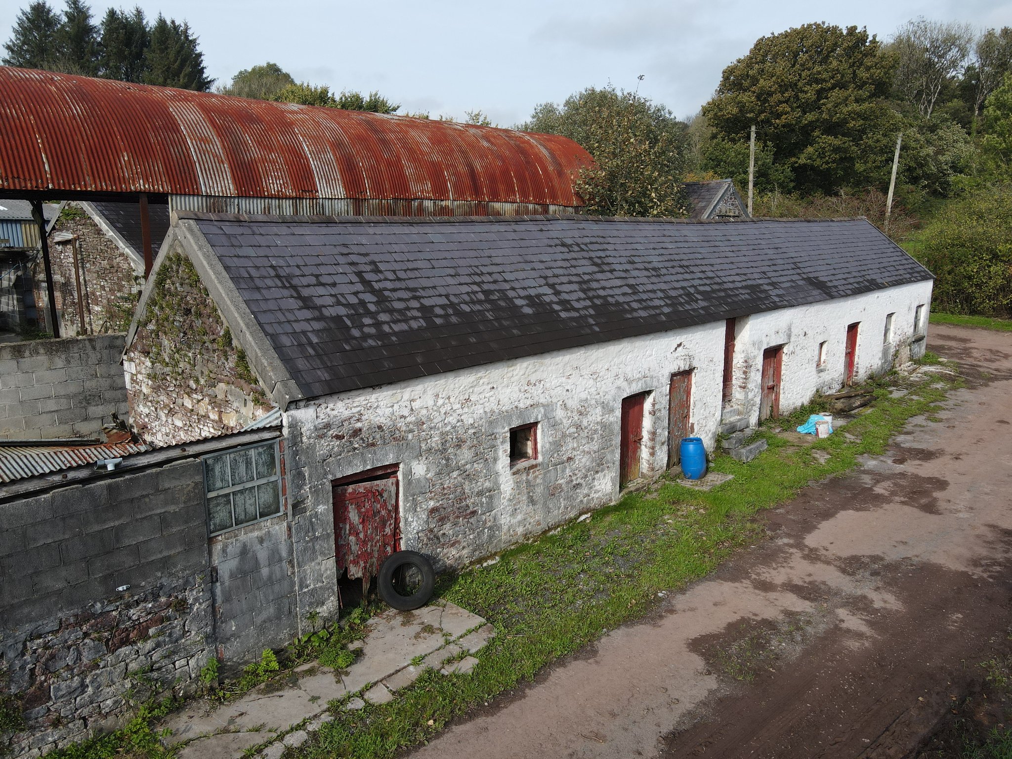
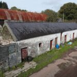
Stone Range
75' x 14' (22.86m x 4.27m)
A traditional stone range under a pitched slate roof consisting of four individual pens/stables with part hay loft above.
Former Loose Housing Shed
20' x 26' (6.10m x 7.92m)
Concrete block built under a timber and corrugated iron sheeted roof, which has collapsed, adjoining the traditional stone range, with attached open ended building housing fuel tanks.
Stone Barn
Approx. 16' 0" x 27' 0" (4.88m x 8.23m)
A traditional stone barn under a pitched slate roof utilised for storage purposes.
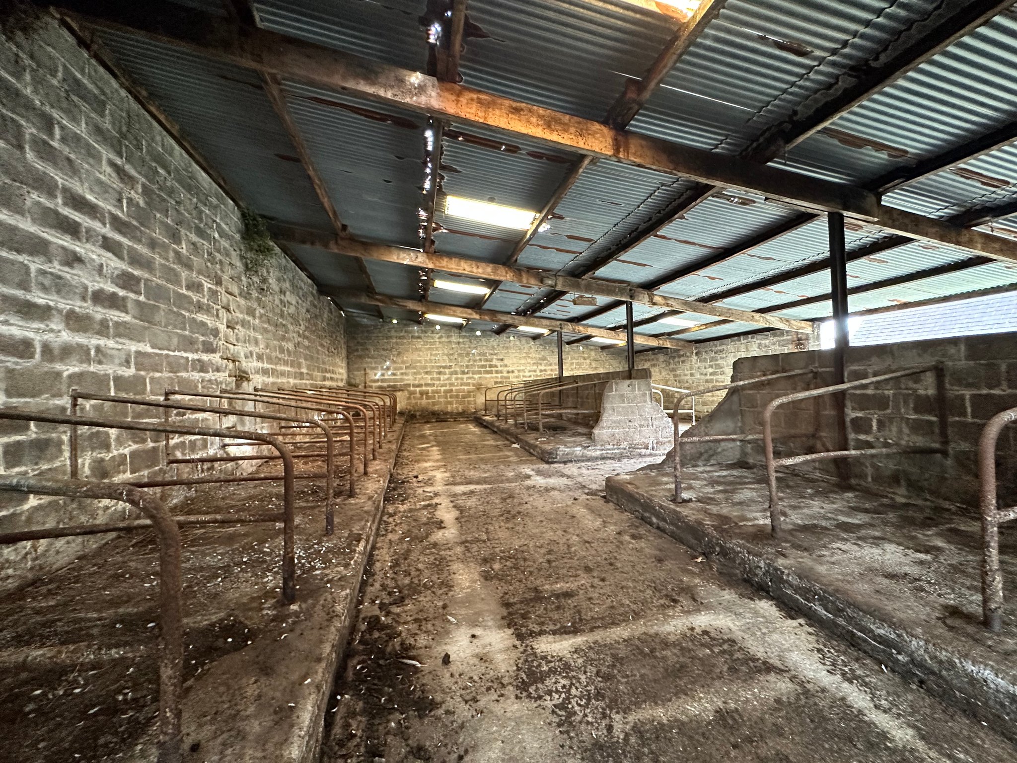
Former Parlour
20' x 48' (6.10m x 14.63m)
A traditional stone barn under a pitched slate roof with herringbone parlour being still in situ.
Former Dairy
12' x 12' (3.66m x 3.66m)
A concrete block built under a sloping fibre cement roof comprising former bulk tank.
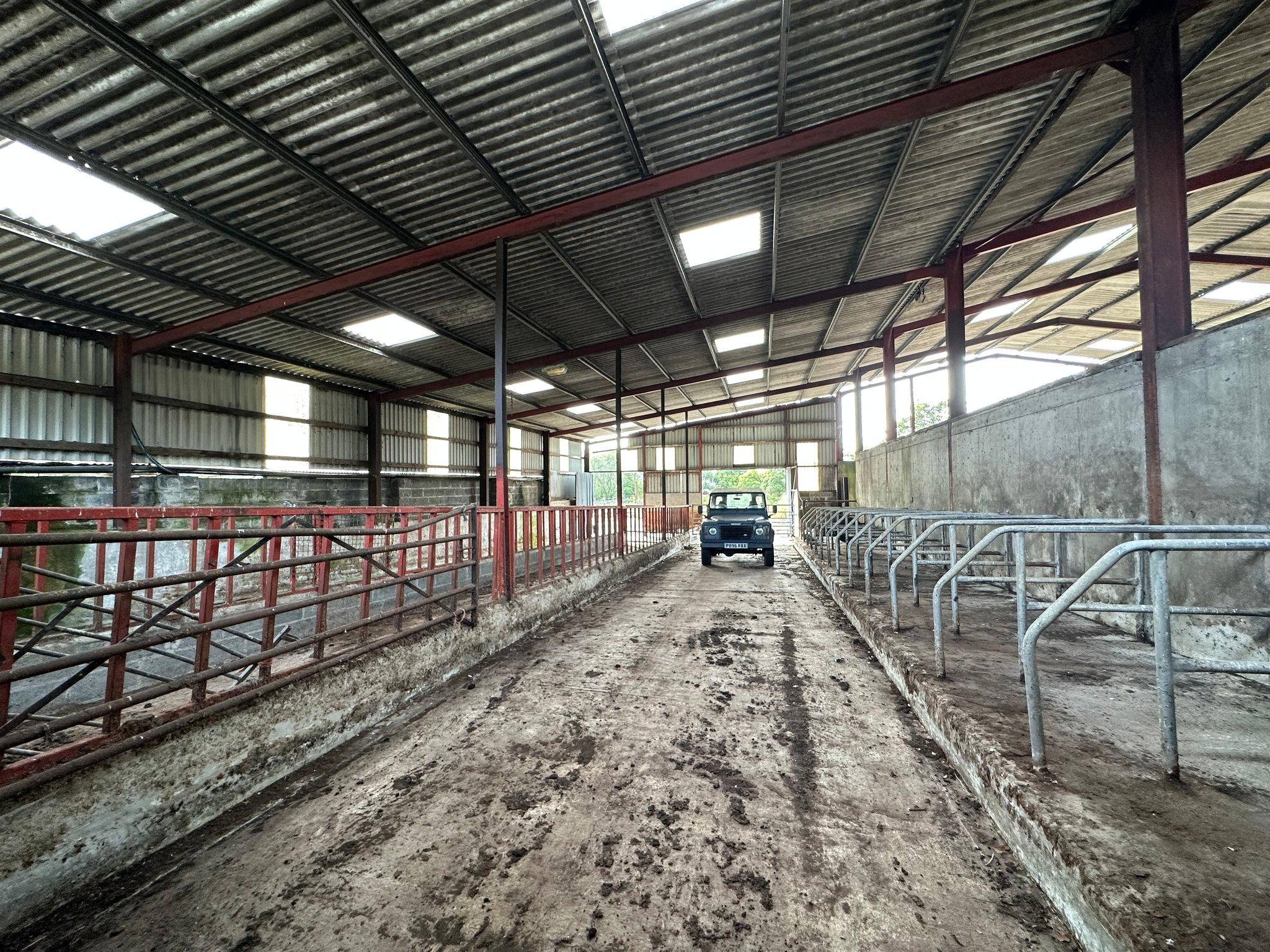
Livestock Housing
28' x 50' (8.53m x 15.24m)
A concrete block built under a sloping corrugated iron roof, which has collapsed in part, adjoining the former parlour comprising approx. 13 Newton Rigg cubicles and feeding barrier.
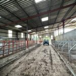
Livestock Housing
40' x 55' (12.19m x 16.76m)
A concrete block built under a sloping corrugated iron roof, consisting of 44 Newton Rigg cubicles.
Loose Housing
40' x 32' (12.19m x 9.75m)
A steel and timber framed under a corrugated iron roof, consisting of 3 loose housing enclosures and open side elevations, to the rear of the above livestock building.
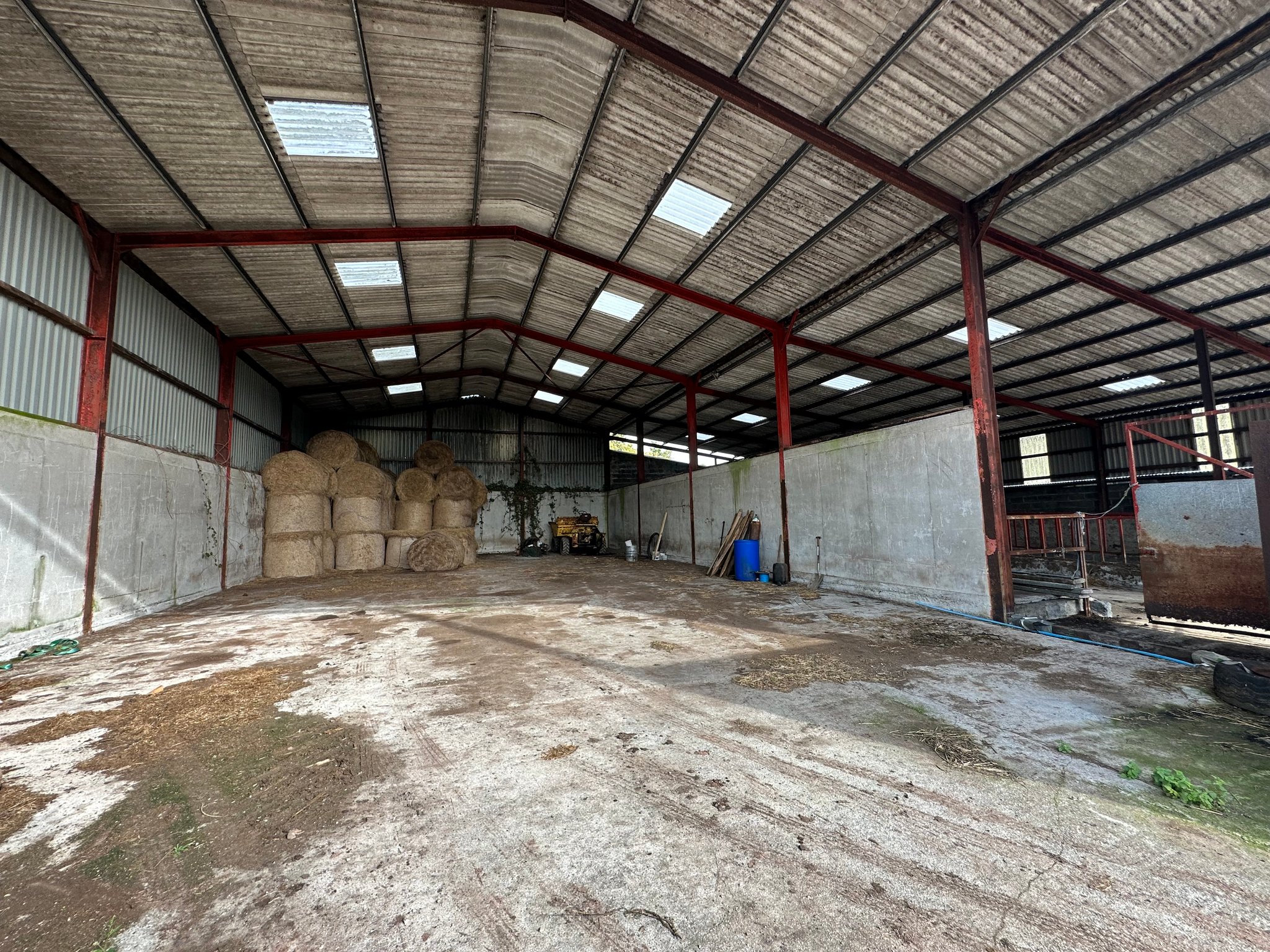
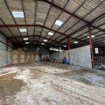
General Purpose Building
40' x 75' (12.19m x 22.86m)
A 5-bay steel framed under fibre cement sheeted roof with part side box profile elevations.
Livestock Housing
40 x 75 (12.19m x 22.86m)
A 5-bay lean-to on the above building of the same construction consisting of Newton Rigg cubicles and central feeding passage.
Dutch Barn
17' x 70' (5.18m x 21.34m)
Steel, timber and corrugated iron construction in need of repair and collapsed lean-to in poor order.
2-Bay Dutch Barn
17' x 50' (5.18m x 15.24m)
Steel, timber and corrugated iron construction in need of repair with lean-to of the same construction extending to approx. 20 ft x 50 ft (6.34m x 15.50m)
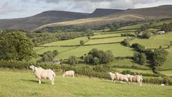
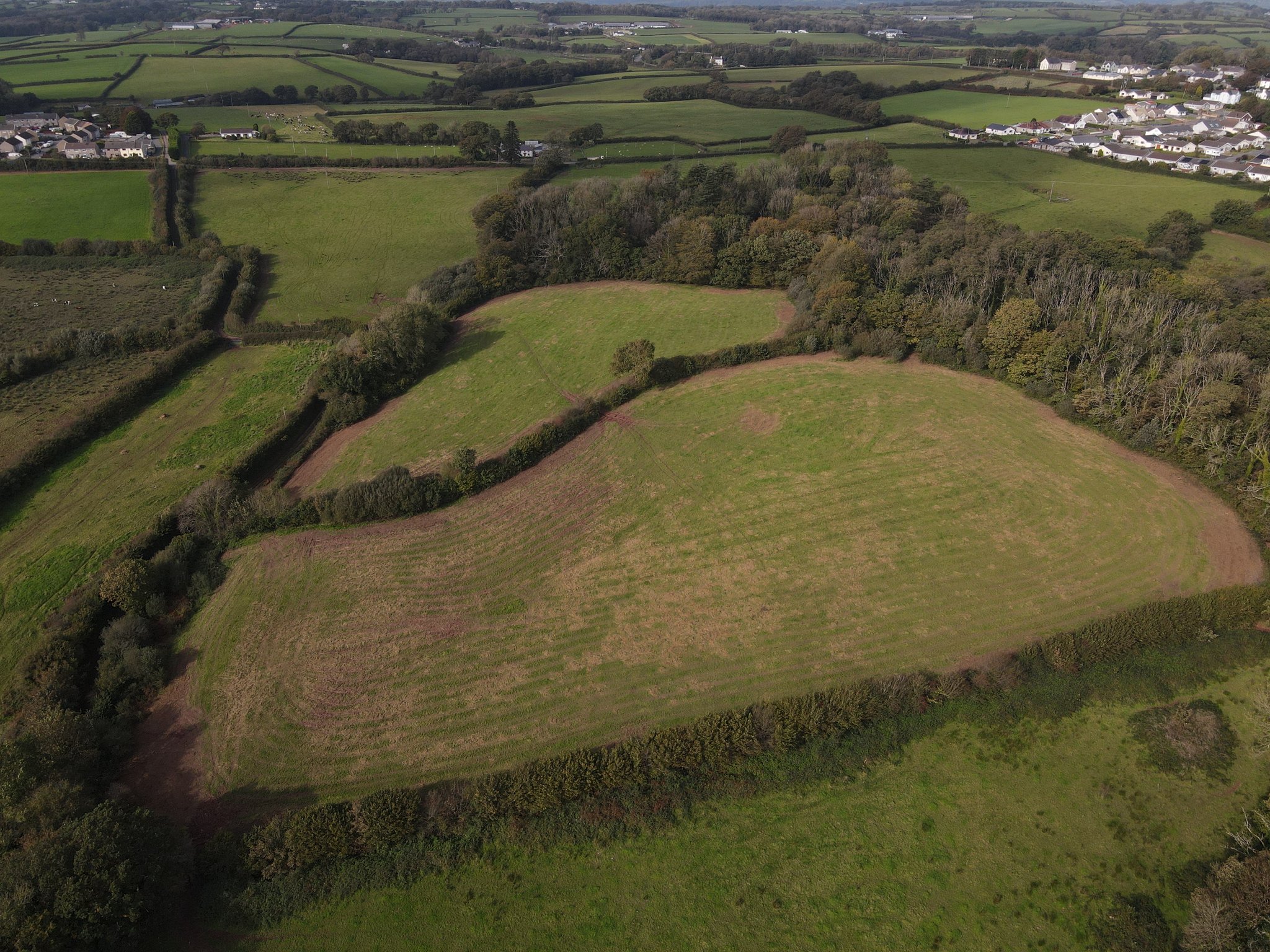
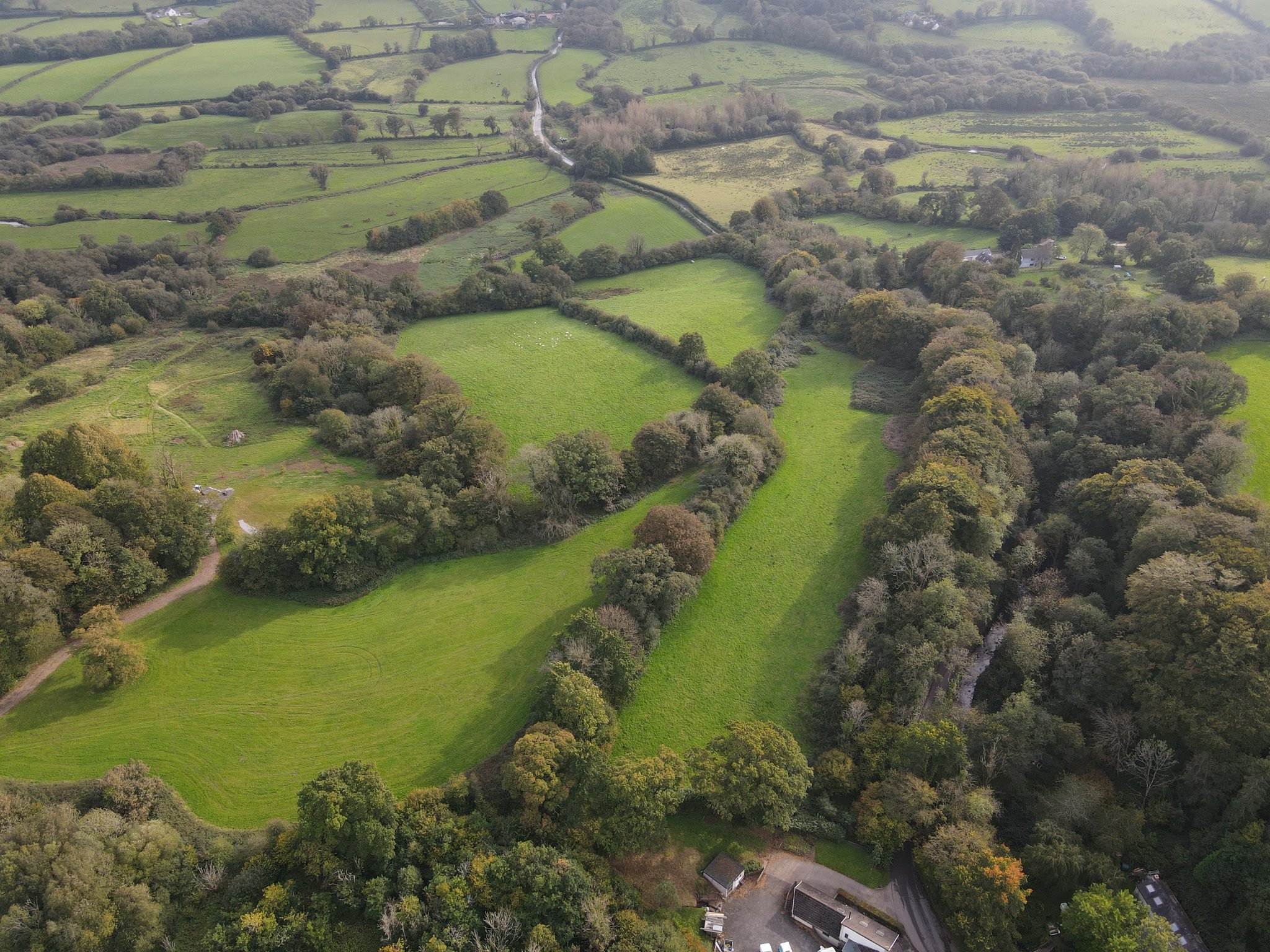
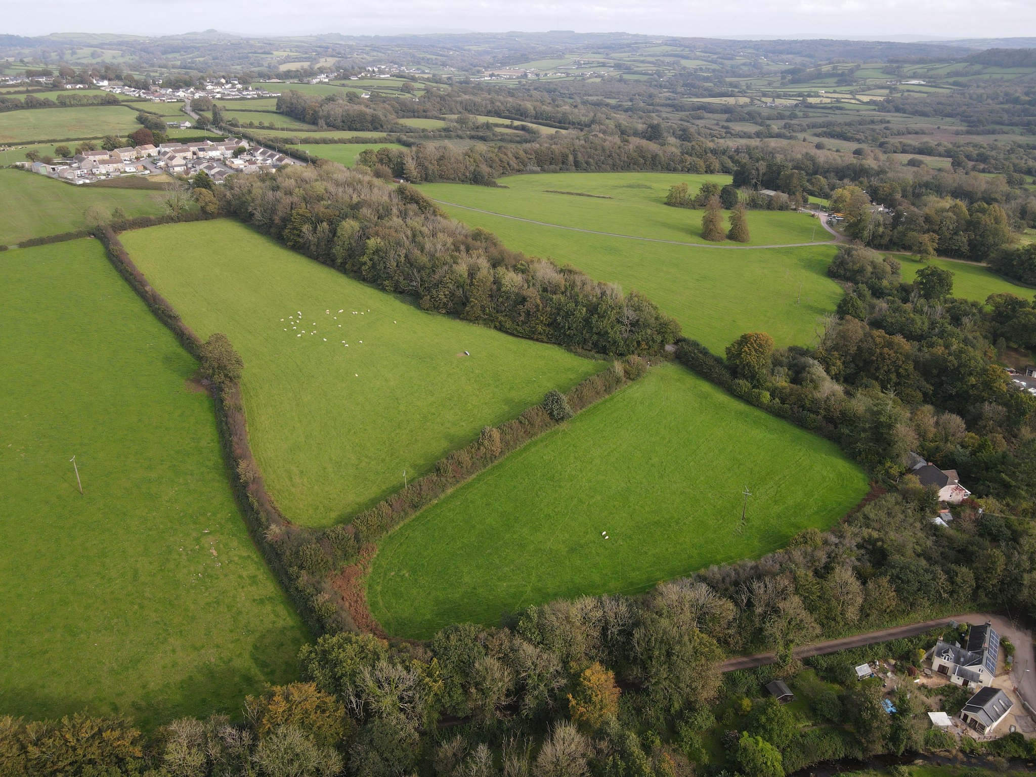
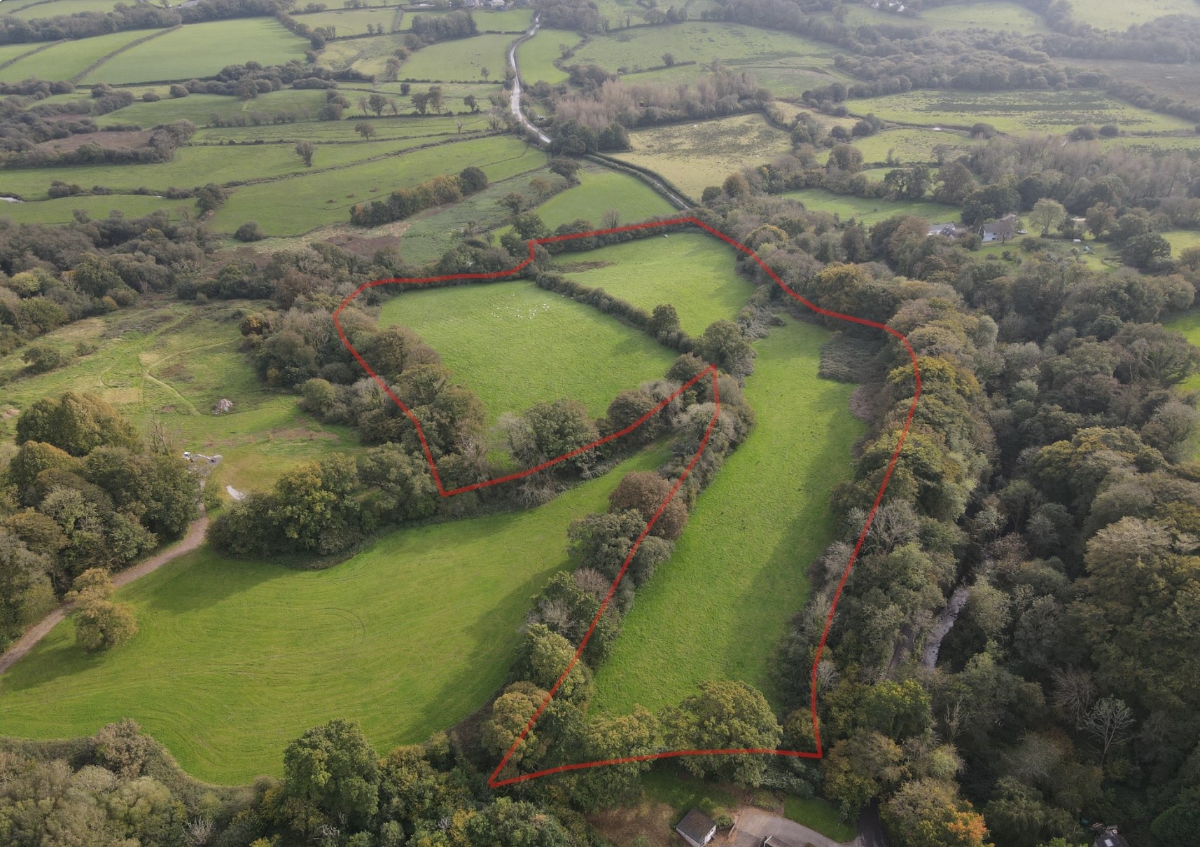
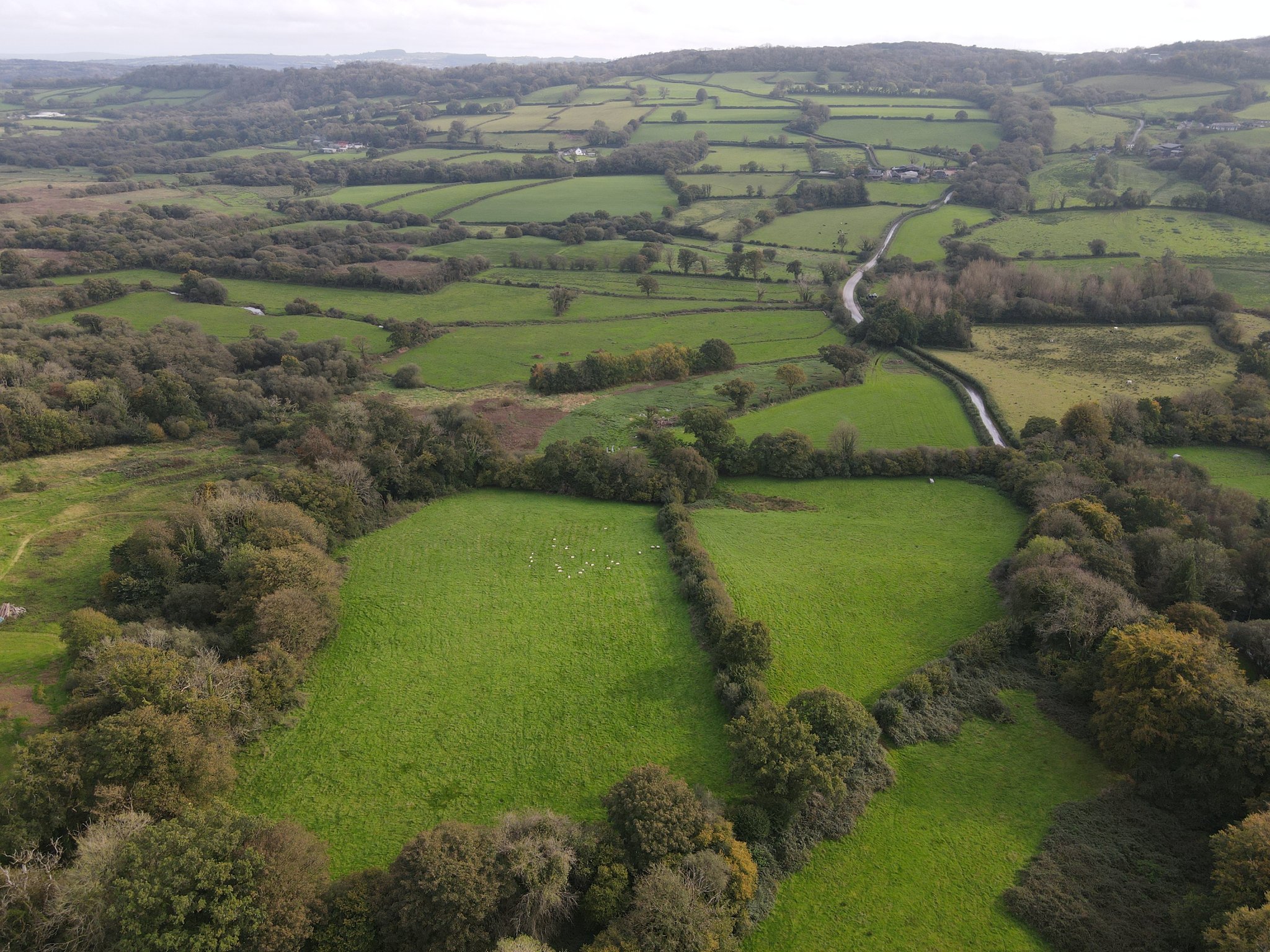
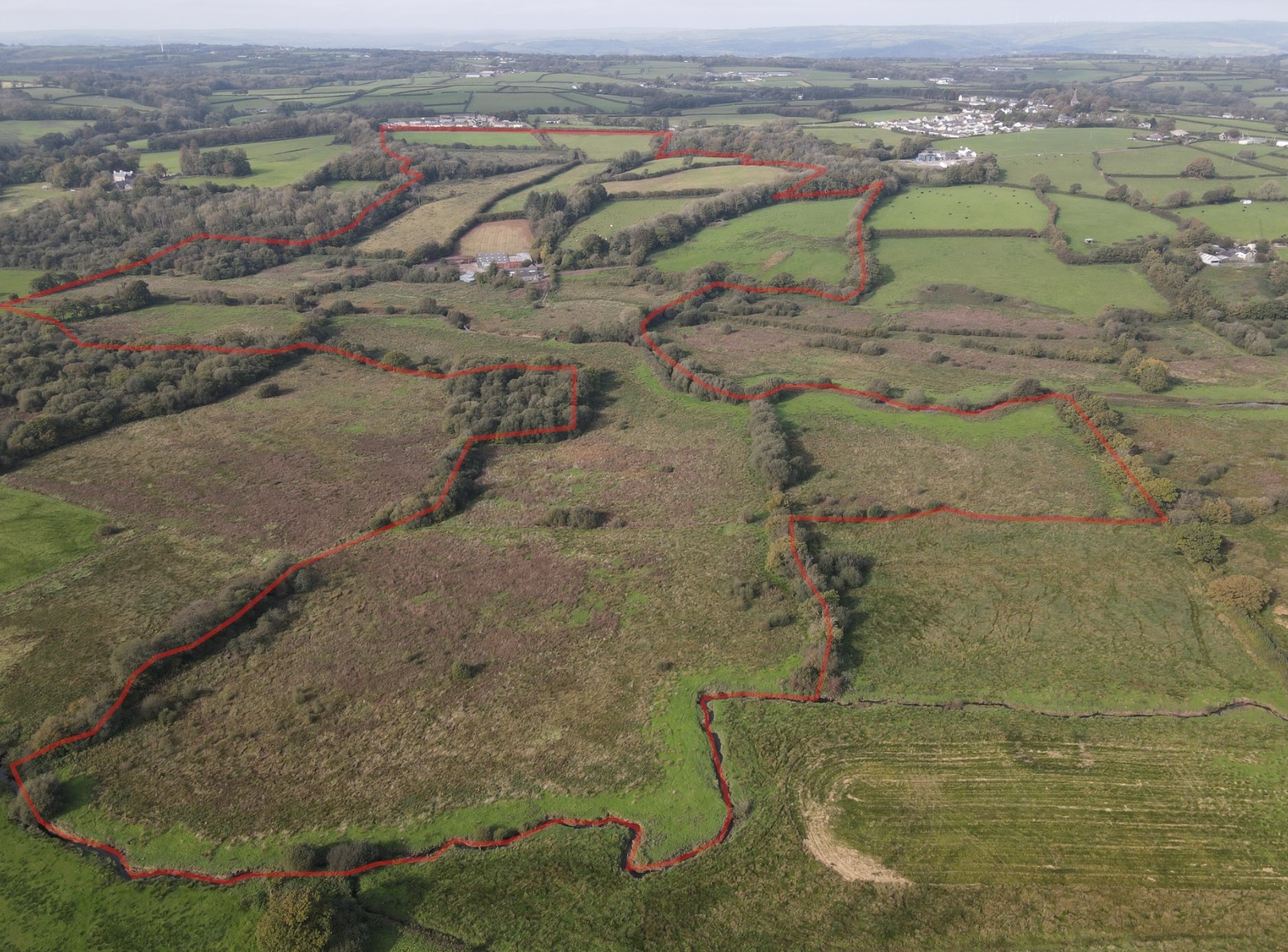
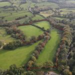
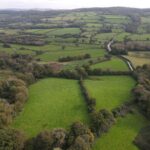
Farmland
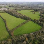
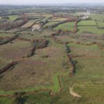
The land ringfenced around the main farmstead extends to approx. 95.90 acres (38.81 hectares) in total, being gently sloping to level valley bottom in nature and divided into 18 enclosures. The land immediately north of the farmstead is classified as freely draining slightly acid loamy soils gently sloping, being laid to old grass ley utilised for grazing and cutting, with an area of mixed broadleaf woodland.
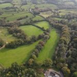
The land immediately south of the farmstead is classified as loamy and clayey floodplain soils with naturally high groundwater being level valley bottom on the banks of the river Gwendraeth Fach and Dulais and laid to rough grazing in nature.
The land benefits from stockproof fencing, some of which requires upgrading. A number of the fields benefit from water troughs supplied by the private water supply. The land is classified as Grade 3a and 3b according to the Agricultural Land Classification Maps.
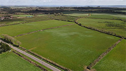
The remaining 20.04 acres is contained in two parcels lies west of the farm itself, being classified as freely draining slightly acid loamy soils. The first parcel lies immediately west of Is-Y-Llan (Former Local Authority housing estate) accessed off the unclassified adopted highway, extending to approx. 9.37 acres (3.79 hectares), with a small area of steep valley edge mixed broadleaf woodland on the south – western boundary extending to approx. an acre. The land is gently sloping in nature and laid to grass, suitable for grazing and cutting, contained within two fields with stockproof fencing and water trough supplied via a private water supply.
The second parcel is situated approx. a mile west of the main farmyard and approx. 0.4 miles south of the above parcel of land, extending to approx. 10.67 acres (4.32 hectares). The land is gently sloping to sloping in nature, with a small area of rough grazing on the southern boundary and an area of steep valley edge mixed broadleaf woodland on the western boundary extending to approx. an acre, immediately adjoining the unclassified adopted highway. The land is contained within three fields with stockproof fencing and accessed directly of the unclassified adopted highway to the western boundary.
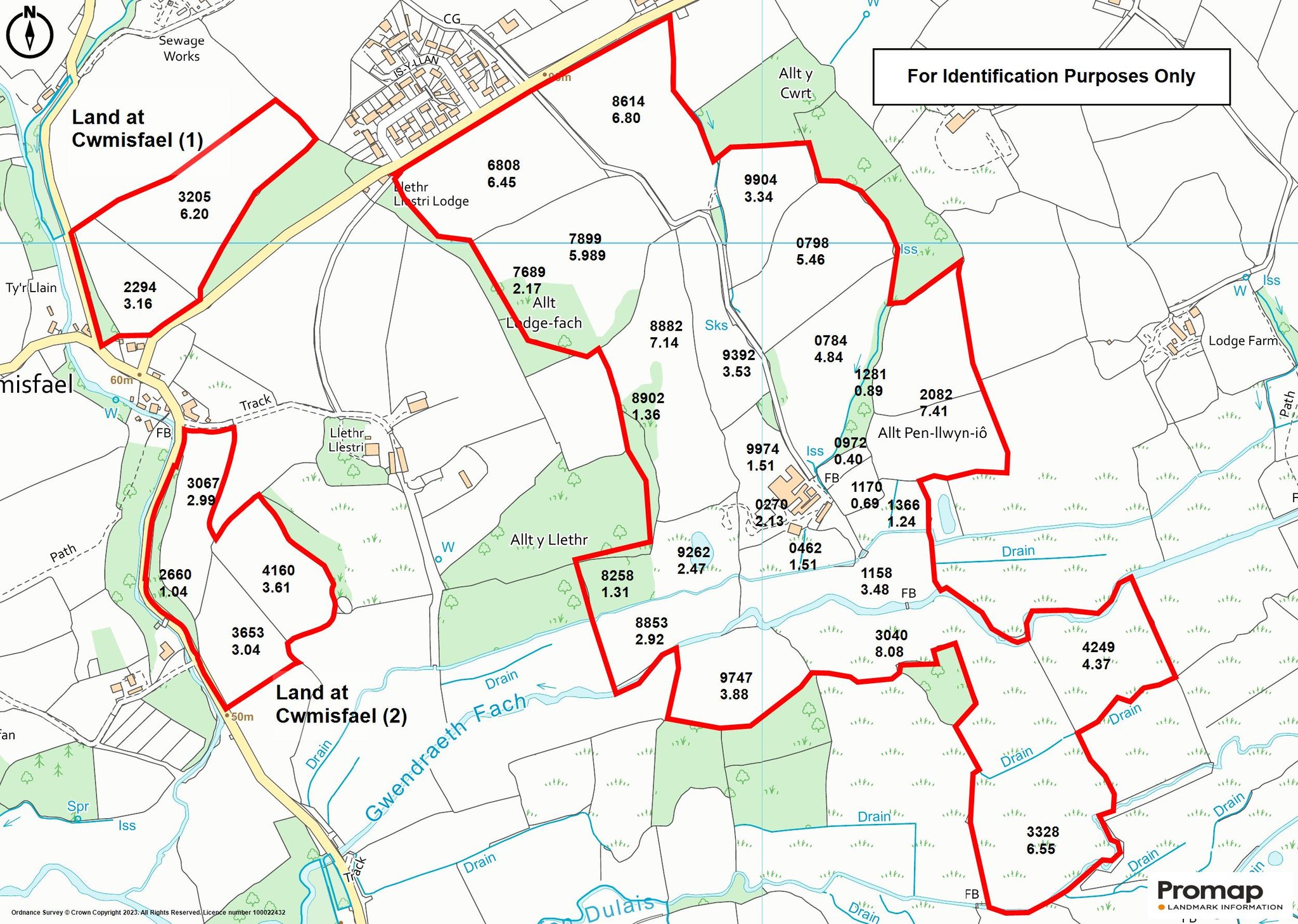
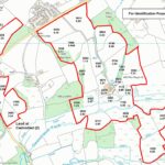
Schedule of Area
Land at Cwrt Farm
OS NO - AC - HA
6808 - 6.45 - 2.61
8614 - 6.80 - 2.75
7899 - 5.98 - 2.42
7689 - 2.17 - 0.88 - wood
8902 - 1.36 - 0.55
8882 - 7.14 - 2.89
9392 - 3.53 - 1.43
9904 - 3.34 - 1.35
798 - 5.46 - 2.21
784 - 4.854 - 1.96
9974 - 1.51 - 0.61
972 - 0.40 - 0.16
1170 - 0.69 - 0.28
2082 - 7.41 - 3.00
1281 - 0.89 - 0.36 - wood
270 - 2.13 - 0.86 - farmstead
8258 - 1.31 - 0.53 - Wood/scrub
9262 - 2.47 - 1.00
462 - 1.51 - 0.61
1366 - 1.24 - 0.50
8853 - 2.92 - 1.18
1158 - 3.48 - 1.41
9747 - 3.88 - 1.57
3040 - 8.08 - 3.27
4249 - 4.37 - 1.77
3328 - 6.55 - 2.65
TOTAL - 95.90 ACRES (38.81 HECTARES)
Land at Cwmisfael 1
OS NO - AC - HA
3205 - 6.20 - 2.51
2294 - 3.16 - 1.28
TOTAL - 9.37 - 3.79
Land at Cwmisfael 2
OS NO - AC - HA
3067 - 2.99 - 1.21
3653 - 3.04 - 1.23
4160 - 3.61 - 1.46
2660 - 1.04 - 0.42 - wood
TOTAL - 10.67 - 4.32
TOTAL FARM - 115.94 - 46.92
Further Information
Tenure
The property is held on a Freehold basis with vacant possession upon completion.
Services
We understand that the farm benefits from mains electricity. Oil fired Aga supplying hot water and radiators. Private water supply via well source in field OS no. 7689. Mains water supply connected to troughs in field OS no. 6808, 8614 and 7899.
None of the services at the property have been tested.
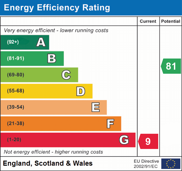
Energy Performance Certificate
EPC Rating G (9).
Council Tax
Cwrt Farmhouse - Council Tax Band E for Carmarthenshire County Council - Approximately £2,332.81 for 2023/2024.
Planning
All planning related enquiries to Carmarthenshire County Council Planning Department.
Rights of Way, Wayleaves and Easements (if any)
The property is sold subject to and with the benefit of all rights, including rights of way, whether public or private, light, support, drainage, water, and electricity supplies and any other rights and obligations, easements and proposed wayleaves for masts, pylons, stays, cables, drains and water, gas and other pipes, whether referenced or not.
We understand the property is subject to a National Grid 11KV overhead powerline and 6 poles transverse OS no. 6808 and 8614 and two National Grid 11KV pole mounted substations in OS no. 6808 and on the farmyard in OS no. 0270.
I.A.C.S.
We understand the property is registered.
Basic Payment Scheme
We understand that all the agricultural land is registered for the Basic Payment Scheme.
Overage Clause
Two fields OS no. 6808 and 8614. Full details to follow - please contact Agents office for further information.
Plans, Areas & Schedules
A copy of the plan is attached for identification purposes only. The purchasers shall be deemed to have satisfied themselves as to the description of the property. Any error or mis-statement shall not annul a sale or entitle any party to compensation in respect thereof.
Post Code / What 3 Word
SA32 8NU / corporate.takes.mime
Viewing
Strictly by appointment with the selling agents.
For further information please contact Rhys James at Rees Richards & Partners Carmarthen office - 12 Spilman Street, Carmarthen SA31 1LQ.
Tel: 01267 612021
Email: rhys.james@reesrichards.co.uk